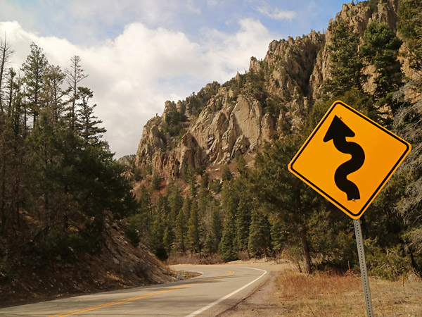
The above picture was taken in the Sangre de Cristo Mountains. Learn more about the SUN BELT TRAIL.
SUN BELT TRAIL ROUTE A (AUTO)
Auto Tour East to West
Auto Tour West to East
DFW and OKC Starting Points
Auto Tour East to West
Oconaluftee Visitor Center, NC (Great Smoky Mountains National Park) (use US 441)
Cherokee, NC (use US 19, US 19/74, NC 28)
Stecoah, NC (use NC 28, NC 143)
(Side Trip Option: Tail of the Dragon, use NC 28, US 129)
Robbinsville, NC (use NC 143, TN 165, aka Cherohala Skyway)
Tellico Plains, TN (use TN 68, TN 39, TN 315)
Reliance, TN (use TN 30, US 74)
Cleveland, TN (use TN 312, TN 58, TN 17)
Chattanooga, TN (use US 41)
Haletown, TN (use TN 134, TN 156)
South Pittsburg, TN (use US 72)
Scottsboro, AL (use US 72)
Huntsville, AL (use I 565, US Alt 72)
Decatur, AL (use US Alt 72)
Muscle Shoals, AL (use US 72)
Florence, AL (use AL 20, Natchez Trace Parkway)
Natchez Trace Parkway Colbert Ferry Park, AL (use Natchez Trace Parkway)
(Side Trip Option: Natchez Trace Parkway to Nashville, TN)
Natchez Trace Parkway Visitor Center, Tupelo, MS (use Natchez Trace Parkway, I 22)
(Side Trip Option: Natchez Trace Parkway to Natchez, MS)
Option: North (Memphis) Route
New Albany, MS (use I 22)
Holly Springs, MS (use I 22)
Byhalia, MS (use US 78)
Memphis, TN (use I 55)
West Memphis, AR (use I 40, US 79)
Marianna, AR (use US 79)
Option: South (Helena) Route
New Albany, MS (use MS 30, MS 7)
Oxford, MS (use US 278, MS 315)
Sardis, MS (use MS 315, US 49, US Bus 49)
Helena-West Helena, AR (US Bus 49, US 49, AR 1)
Marianna, AR (use US 79)
Clarendon, AR (use US 79)
Stuttgart, AR (use US 165)
England, AR (use US 165, US 70)
North Little Rock, AR (use US 70B)
Little Rock, AR (use AR 10)
Williams Junction, AR (use AR 9, AR 5, AR 7)
Hot Springs, AR (use US 270, US 71)
Mena, AR (use AR 88, OK 1, aka Talimena National Scenic Byway)
Talihina, OK (use OK 1, OK 2, OK 43, US 69)
Atoka, OK (use OK 7)
Sulphur, OK (use OK 7)
Davis, OK (use OK 7)
Duncan, OK (use OK 7)
Lawton, OK (use I 44, OK 49)
Medicine Park, OK (use OK 49, OK 54, OK 19)
Roosevelt, OK
Option: East (Hobart) Route
Roosevelt, OK (use US 183)
Hobart, OK (use US 183)
Clinton, OK (use I 40, Historic US Route 66)
Elk City, OK (use OK 6, US 283)
Option: West (Granite) Route
Roosevelt, OK (use OK 19, OK 6)
Granite, OK (use OK 6)
Elk City, OK (use OK 6, US 283)
Cheyenne, OK (use OK 47, OK 30, OK 33, TX 33, US 60)
(Side Trip Option: Canadian, TX)
Pampa, TX (use TX 152)
Borger, TX (use TX 136)
Stinnett, TX (use TX 152, US 87)
Dalhart, TX (use US 87)
Texline, TX (use US 87)
Clayton, NM (use US 87)
Capulin, NM (use US 87)
Raton, NM (use I 25, US 64)
Cimarron, NM (use US 64)
Eagle Nest, NM (use US 64)
Taos, NM (use NM 68)
Ranchos de Taos, NM (use NM 68)
Española, NM (use US 285, US 84)
Abiquiu, NM (use US 84)
Ghost Ranch, NM
Rocky Mountains Western Loop Option
Ghost Ranch, NM (use US 84)
Tierra Amarilla, NM (use US 64)
Tres Piedras, NM (use US 64)
Taos, NM
Western Return Loop Option
Taos, NM (use NM 68)
Ranchos de Taos, NM (use NM 518, NM 75, NM 76)
Chimayo, NM (use NM 503, US 84/285)
Santa Fe, NM (use US 84/285, NM 14)
Madrid, NM (use NM 14)
Cedar Crest, NM
West - Albuquerque, NM (use I 40 West)
East - Santa Rosa, NM (use I 40 East)
Tucumcari, NM (use I 40 East)
Amarillo, TX (use I 40 East)
Shamrock, TX (use I 40 East)
Elk City, TX (use I 40 East)
Oklahoma City, OK
Auto Tour West to East
Ghost Ranch, NM (use US 84)
Abiquiu, NM (use US 84, US 285)
Española, NM (use NM 68)
Ranchos de Taos, NM (use NM 68)
Taos, NM (use US 64)
Eagle Nest, NM (use US 64)
Cimarron, NM (use US 64, I 25)
Raton, NM (use US 87)
Capulin, NM (use US 87)
Clayton, NM (use US 87)
Texline, TX (use US 87)
Dalhart, TX (use US 87, TX 152)
Stinnett, TX (use TX 136)
Borger, TX (use TX 152)
Pampa, TX (use US 60, TX 33, OK 33, OK 30, OK 47)
(Side Trip Option: Canadian, TX)
Cheyenne, OK
Option: West (Granite) Route
Cheyenne, OK (use US 283, OK 6)
Elk City, OK (use OK 6)
Granite, OK (use OK 6, OK 19)
Roosevelt, OK (use OK 19, OK 54, OK 49)
Option: East (Hobart) Route
Cheyenne, OK (use US 283, OK 6)
Elk City, OK (use I 40, Historic US Route 66)
Clinton, OK (use US 183)
Hobart, OK (use US 183)
Roosevelt, OK (use OK 19, OK 54, OK 49)
Medicine Park, OK (use OK 49 I 44)
Lawton, OK (use OK 7)
Duncan, OK (use OK 7)
Davis, OK (use OK 7)
Sulphur, OK (use OK 7)
Atoka, OK (use OK 1, OK 2, OK 43, US 69)
Talihina, OK (use OK 1, AR 88, aka Talimena National Scenic Byway)
Mena, AR (use US 71, US 270)
Hot Springs, AR (use AR 7, AR 5, AR 9)
Williams Junction, AR (use AR 10)
Little Rock, AR (use US 70B)
North Little Rock, AR (use US 70, US 165)
England, AR (use US 165)
Stuttgart, AR (use US 79)
Clarendon, AR
Option: North (Memphis) Route
Clarendon, AR (use US 79)
Marianna, AR (use I 40, US 79)
West Memphis, AR (use I 55)
Memphis, TN (use US 78)
Byhalia, MS, (use I 22)
Holly Springs, MS (use I 22)
New Albany, MS (use I 22, Natchez Trace Parkway)
Option: South (Helena) Route
Clarendon, AR (use US 79)
Marianna, AR (AR 1, US 49, US Bus 49)
Helena-West Helena, AR (use US Bus 49, US 49, MS 315)
Sardis, MS (use US 278, MS 315)
Oxford, MS (use MS 30, MS 7)
New Albany, MS (use I 22, Natchez Trace Parkway)
Natchez Trace Parkway Visitor Center, Tupelo, MS (use Natchez Trace Parkway)
(Side Trip Option: Natchez Trace Parkway to Natchez, MS)
Natchez Trace Parkway Colbert Ferry Park, AL (use Natchez Trace Parkway, AL 20)
(Side Trip Option: Natchez Trace Parkway to Nashville, TN)
Florence, AL (use US 72)
Muscle Shoals, AL (use US Alt 72)
Decatur, AL (use US Alt 72, I 565)
Huntsville, AL (use US 72)
Scottsboro, AL (use US 72)
South Pittsburg, TN (use TN 156, TN 134)
Haletown, TN (use US 41)
Chattanooga, TN (use TN 17, TN 58, TN 312)
Cleveland, TN (use US 74, TN 30)
Reliance, TN (use TN 315, TN 39, TN 68)
Tellico Plains, TN (use TN 165, NC 143, aka Cherohala Skyway)
Robbinsville, NC (use NC 143, NC 28)
(Side Trip Option: Tail of the Dragon) (use US 129, NC 28)
Stecoah, NC (use NC 28, US 19/74, US 19)
Cherokee, NC (use US 441)
Oconaluftee Visitor Center, NC (Great Smoky Mountains National Park)
Appalachian Mountains Eastern Options
Blue Ridge Parkway
Great Smoky Mountains National Park (use US 441 to Gatlinburg, TN
Eastern Return Loop Option
Cherokee, NC (use US 19)
Atlanta, GA (use I 20 or US 80)
Montgomery, AL (use US 80)
Selma, AL (use US 80)
Meridian, MS (use I 20)
Jackson, MS (use I 20)
Vicksburg, MS (use I 20 or US 80)
Monroe, LA (use I 20)
Minden, LA (use I 20)
Shreveport, LA (use I 20, US 80)
Marshall, TX (use US 80)
Longview, TX (use I 20)
Canton, TX (use I 20, US 80)
Dallas, TX
DFW and OKC Starting Points
Dallas-Fort Worth and Oklahoma City are given as examples of potential starting and return points for those who may decide to tour the trail in segments.
Dallas-Fort Worth Access to the East
Garland, TX (use TX 78)
Farmersville, TX (use TX 78, TX 121)
Bonham, TX (use US 82)
Paris, TX (use US 271)
Antlers, OK (use US 271)
Talihina, OK (use OK 1)
Join the Sun Belt Trail
Dallas-Fort Worth Access to the Center (Davis)
Denton, TX (use I 35)
Ardmore, OK (use I 35) (Note: Ardmore is served by Amtrak)
Davis, OK (use OK 7 to East or West)
Dallas-Fort Worth Access to the West
Fort Worth, TX (use US 287)
Decatur, TX (use US 287)
Bowie, TX (use US 81)
Duncan, OK (use OK 7)
Join the Sun Belt Trail
Oklahoma City Access to the Center (Davis)
Oklahoma City, OK (use I 35)
Norman, OK (use I 35)
Davis, OK (use OK 7 to East or West)
DIRECTIONS FOR USE
The place names listed are major points on the Sun Belt Trail, Route A (Auto). The information is provided to help you plot your course.
Determine the direction you want to go (e.g. East to West or West to East), then use the highway designation information in parentheses to get to the next major point, which is listed below your starting point. Note that directional information (N, S, E, W) is not yet provided. You should use a map or GPS to be certain you are traveling the correct direction to get to your next destination.
Though directional information (N, S, E, W) is planned to be added for those who may need or want the information, it will still be recommended to use an electronic map or GPS to confirm you are traveling in the planned direction, and also to have access to up-to-date road conditions.
FREQUENTLY ASKED QUESTIONS
Question: Are maps available for cyclists, hikers and paddlers?
Answer: A map with many recreation opportunities is being developed and will be shared soon. As far as a full end-to-end route, the next one that is being prepared is a cycling route. A full hiking route will require substantially more time, since it will involve the most actual trail development.
Several hundred miles in the Sun Belt Trail Corridor are currently available for hikers and paddlers, primarily by utilizing existing trails and waterways. Information about those will be provided soon.
A unique feature of the Sun Belt Trail Corridor is that it is possible to complete the length of the trail utilizing various modes of transportation, including hiking, biking and canoeing different segments. Though it would require advanced preparation and even tour support, the organization plans to present information about that unique optional experience in the future.
ABOUT THE SUN BELT TRAIL
The Sun Belt Trail connects the Appalachian Mountains and the Rocky Mountains by crossing the Mississippi Delta, Interior Highlands, Southern Great Plains, Raton-Clayton Volcanic Field and Sangre de Cristo Mountains.
The Sun Belt Trail is a multimodal trail corridor that provides opportunities for auto touring, cyling, hiking, and canoeing and kayaking.
Sun Belt Trail Route A (Auto) is described and in use. Route B (Bike) will be described soon for cyclists. Opportunities to use Routes C and D on waterways and footpaths will also be presented soon, while the next major goal to complete a hiking route within the Sun Belt Trail Corridor between the Appalachian Trail and Continental Divide Trail is in the works.
Learn more about the SUN BELT TRAIL. Join us on Facebook
|